Tuesday, January 2, 2018

Taste Of HariharGad Nashik (3676 Feet)

Panaroma View HariharGad Nashik 3676 Feet
Hi Guys,
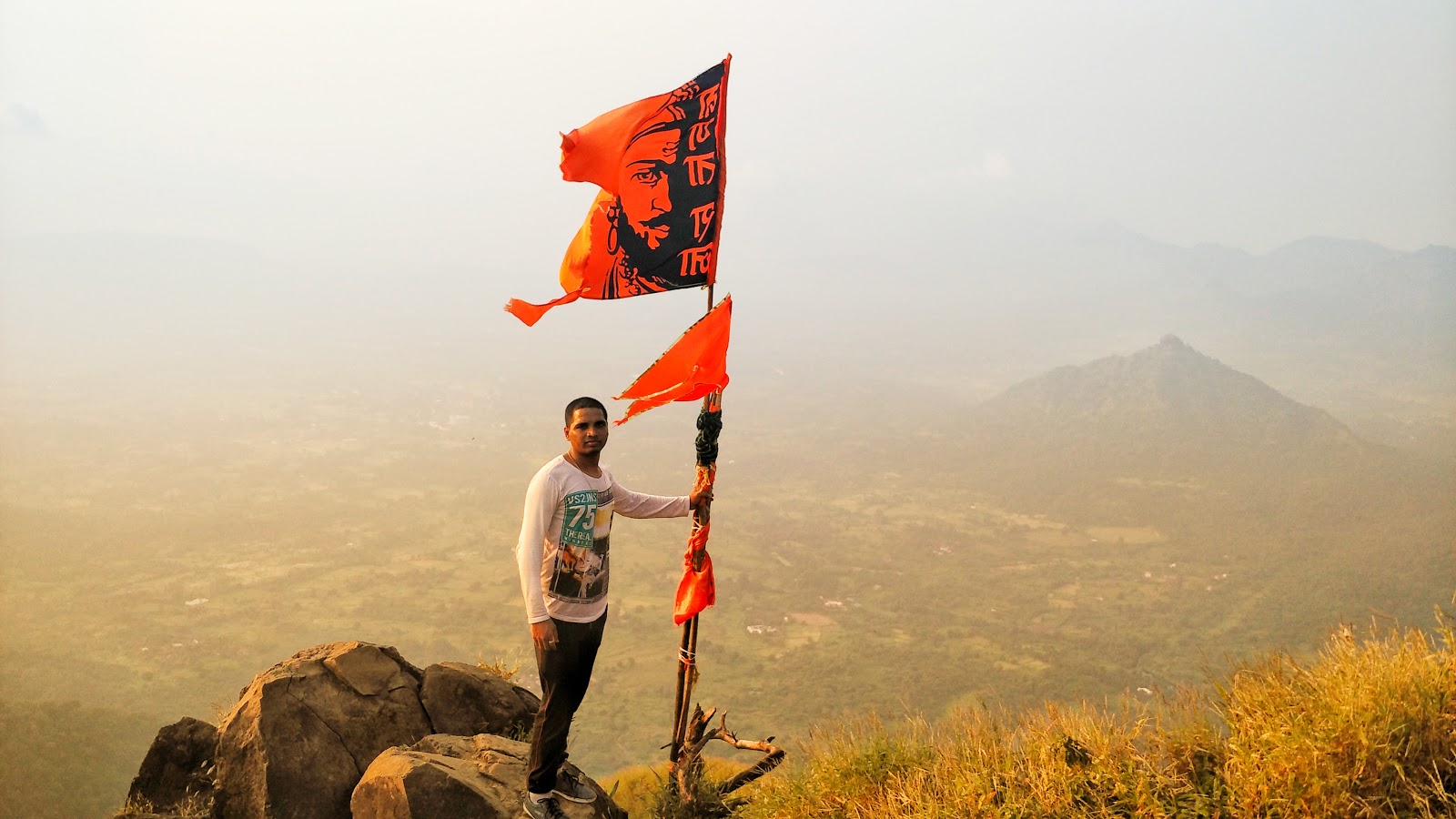
What an day to introduce my new blog at start of the year 2018 with an amazing and thrilling experience of our trek to Harihar Fort Nashik (Trambekeshwar).After a breath taking experience of Kalavanti Durg Pinnacle, it was time for our new trek to Harihar Fort which is almost 3676 Feet above sea level surface.
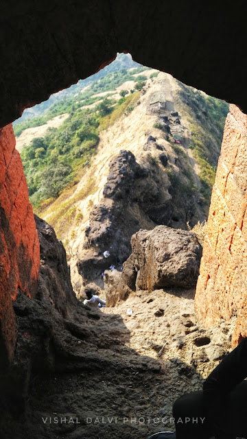
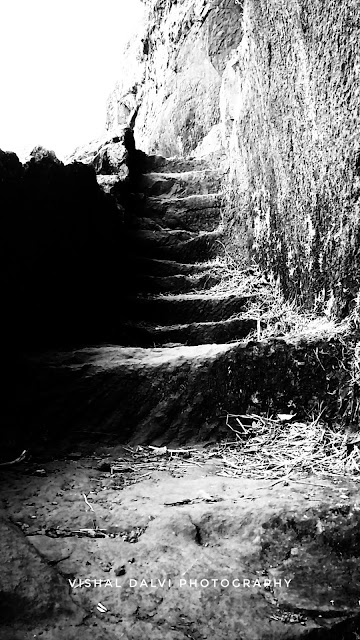
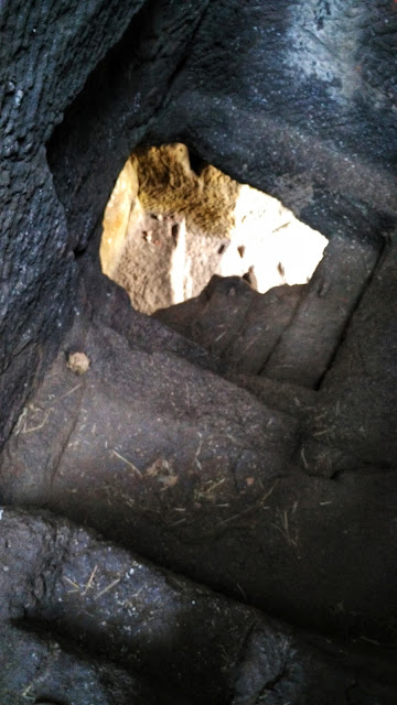
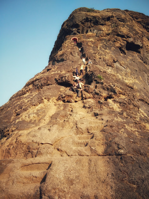
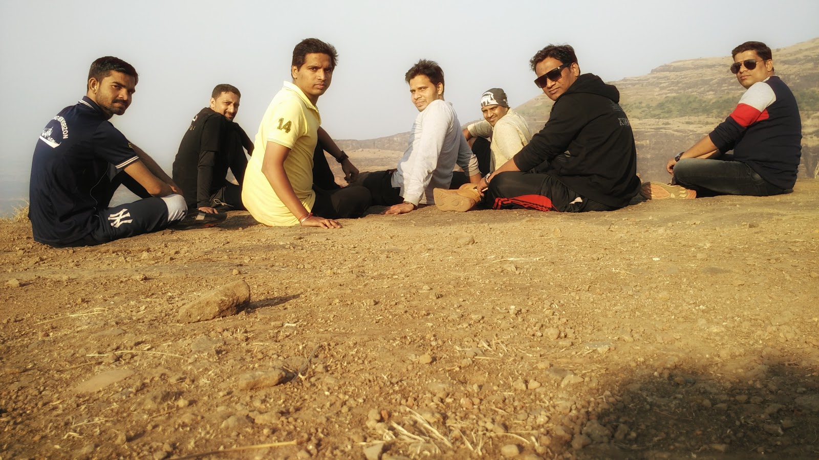
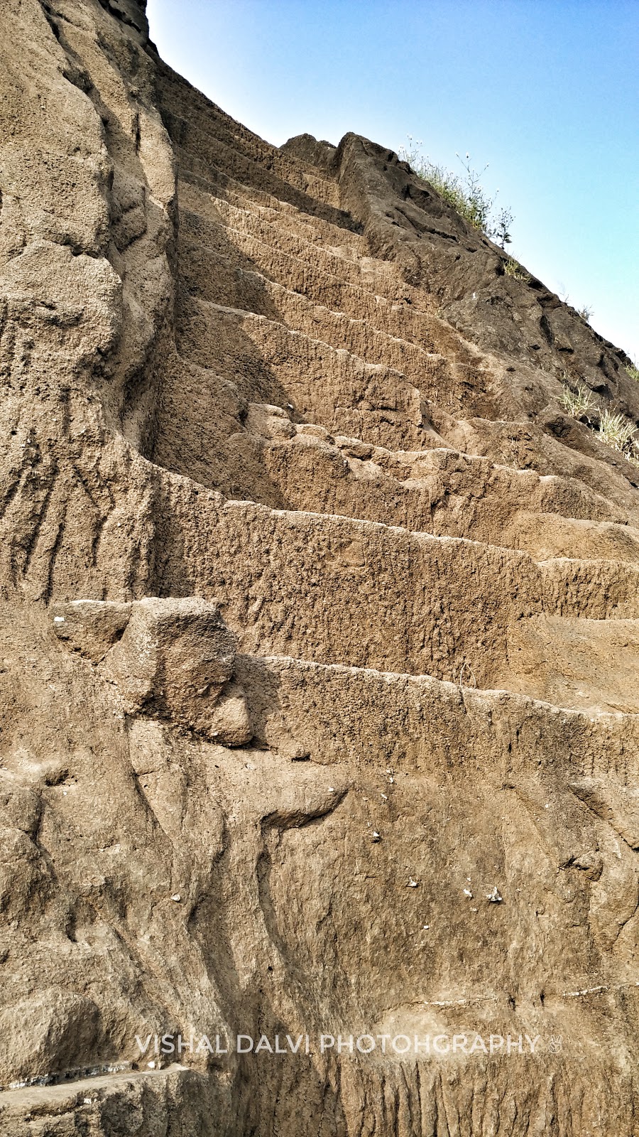
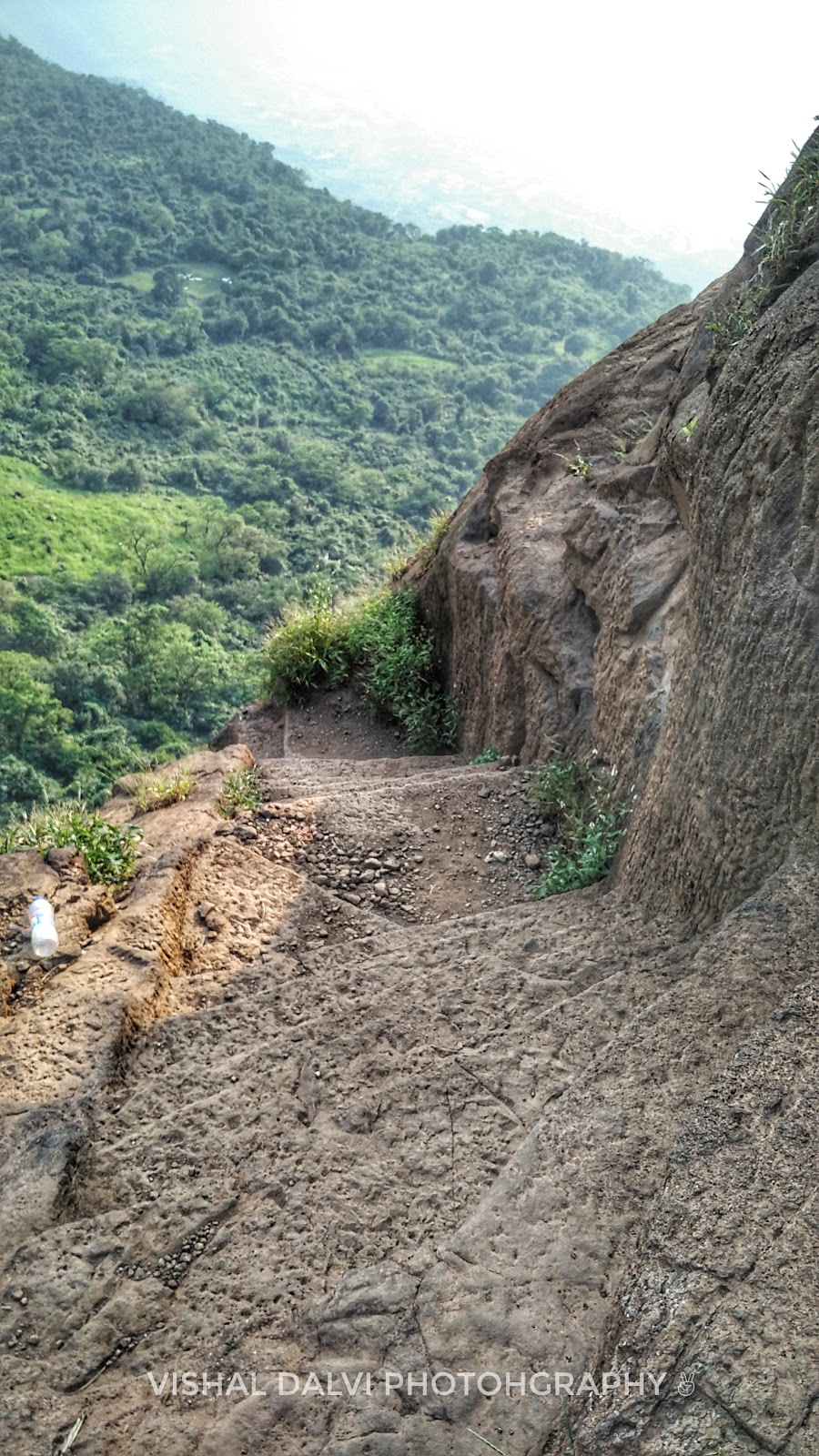
The day begins on 30th December 2017 an year ending scenario.We started our journey from Virar which had Jitesh Ahire,Sandeep Sawant,Roshan Pawar,Mangesh Bhuvad,Sandesh Bhosle,Sachin and Dhawal Patel.We were in a group of 8 ppls along with 4 bikes riding at 5:00am in this chilled and blissing climate on Mumbai-Ahemadabad Highway.We had decided to take the shortcut route to Nashik via Manori and Jawahar road which in itself is one of the best places we had seen through this drive of 140Km (Virar to Nashik).Amazing ride foggy weather with a cup of Tea on our first hault at Manori Fata bypass.We had a snacks at Manori and started routing once again to Jawahar road.You will experience a beautiful climate and extreme turns on Jawahar Ghat,crossing further we had hault at Vikramgad which is market place where you can have your stuff filled again.Heading towards Nashik on this road we didn't found any traffic which made our journey easy and stress free.Finally we reached  Trambakeshwar which is the pilgrim place 40km away from Nashik.We booked an hotel room at Trambakeshwar were he had accommodated 8 of us.We had taken a break of 2 hours at this place and moved to Harihar Fort which is 18-20 km from  Trambakeshawar.Reaching the base village near the fort you can view a grand cannon like structure almost 2-3 km long with cliffs around yes it was the "Harihar Fort".Parking our bikes to the near by Hut like house we moved on the forest path.
Harihar fort is surrounded by forest but quite visible so there is no chance that you can get diverted to wrong path.There are cliffs and patches around easiest way is to follow the village path used by locals.Reaching a point were you can see the Vertical Steps is the best feeling.One by one we had climbed the Vertical patch of Harihar fort,we had reached the middle portion of this fort with small resting place around,moving further we had gone through a tunnel like structure with stairs which is almost like a dead wall.After crossing this we had reached the final top which is called "Harihargad".Experiencing the immense 360 degree view of mother nature is the best feeling we had on this trek.We had shared some pics from our trek to Harihar hope you will like it.

Thanks,
Vishal Dlavi
Copyright reserved @ https://dalvivishal.blogspot.in/


Thursday, December 14, 2017

Kalavanti Durg - The Heaven On Earth

Hi Friends,
Almost done with 15 treks with my childhood friends & "Mitra Mandal" across Maharashtra,i never experienced the “KalavantinDurg” which was my 16th One to trek.

We always had fun experiencing such forts.This time i decided to climb this pinnacle point which looks beautiful from ground surface.The fort is surrounded with forest and valleys which makes it one of the adventures rock structure.We traveled 100 km from "Virar to Kalavantin" on our motorcycles with cool climate around us.You have a pay & park system below the fort so no worries friend.Only carry enough water and food so there will be no dehydration issues.We had almost carried 10 ltrs. of water baggage,some glucose biscuits and chocolates. 
We started trekking in afternoon, as we got late early in the morning due to some vehicle issues.Trekking in the afternoon was dangerous as we were having no idea how much time it will take to reach the point.As it was afternoon the sun was heavy on our heads almost exhausted us.Carrying enough food and water was the reason that we climbed the fort. You will see small village up there and also a plateau area were we have small hut type resting places, were you can order food.The climb was pretty tough but the best portion which i witnessed was the snake pattern rock cut down steps.This steps were so dangerous and tricky at some part with no boundary walls or protection around.
Concentration is only the weapon you have while climbing such steps.Tricky edges & turns made it look so dangerous.Another portion i witnessed was the final pinnacle point which was almost 20-25 ft. from main surface which was the last point of "KalavantinDurg" with Maratha flag on it.The final highlight of this point was the 360 degree bird eye view from 2300 ft above sea level.
I was exhausted broken restless while climbing "Kalavantin" fort but it all paid off with this immense 360 view from top which i had experienced.My love towards mother nature and this Maratha forts will never end.

Thank you guys for reading my blog,here are some information and pics we had shared from our trek to "KalavantinDurg".


Kalavantin Intro:-

Kalavantin Durg is located on Western Ghats near Mumbai (Panvel), at a high altitude of 
700 Mtr (2,300 feet) above sea level. Which was constructed in honour of a Queen Kalavantin.
It was used as watch tower for “Prabhalgad” the next rock structure besides Kalavantin pinnacle. Offering gorgeous views and abundant beauty – via rugged terrain with narrow rock-cut steps, steep slopes and no support around.
Kalavantin Fort is named as the ‘Climb to Heaven’, owing to its dangerous nature and the bird’s eye view of the immense beauty that await atop.


Thanks,

Vishal Dalvi

Taste Of HariharGad Nashik (3676 Feet)